Trail Guide
The Lost Lake Loop, Mile by Mile
A 7.2-mile loop that front-loads the climbing, pays it off at an alpine lake most people turn around before reaching, and makes you earn the way back out through an old burn scar.
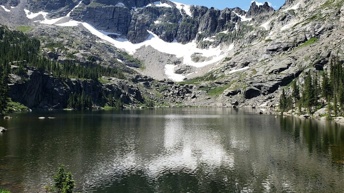
Lost Lake isn't actually hard to find — the name comes from a surveyor's mislabeled 1932 map that stuck, not from the trail being hard to follow. It's a well-marked 7.2-mile loop that does something a lot of lake hikes don't: it puts almost all of the climbing in the first half, so you're earning the payoff instead of grinding out a climb at the end of a tired day.
The loop is doable as a half-day hike for most people in good shape, but budget 4 to 5 hours if you want real time at the lake rather than a 20-minute photo stop. We'll walk through it the way most people hike it: counterclockwise, overlook first.
Trailhead to the First Overlook (Miles 0–1.8)
From the trailhead parking area, the trail climbs immediately through a mixed fir and pine forest, gaining about 700 feet in the first mile and a half — the steepest sustained section of the whole loop. It's switchbacked well enough that the grade never feels brutal, but it's not a warm-up either; this is the climbing you came for, done early.
At 1.8 miles, a short spur trail (signed, easy to spot) leads 200 feet off the main loop to an overlook with the first real view of the valley behind you. Most day hikers treat this as a turnaround point if they're short on time, and it's a legitimate destination on its own if the full loop isn't in the cards.
The Lake Basin Approach (Miles 1.8–3.4)
Past the overlook spur, the trail mellows considerably, contouring along the basin's upper edge with another 500 feet of gain spread over 1.6 miles. This stretch crosses two small seasonal creeks that are reliable from snowmelt through mid-July and usually dry by late August — don't count on them as a water source after midsummer.
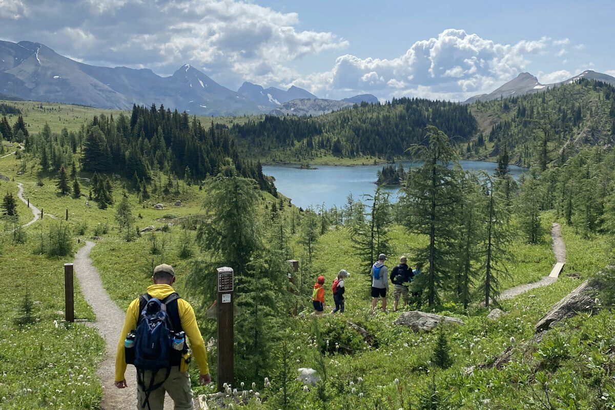
You'll get your first glimpse of Lost Lake itself around mile 3, framed between two granite shoulders, before the trail drops the final quarter mile to the shoreline.
Lost Lake and the Best Lunch Spot (Mile 3.4)
The lake sits at 7,900 feet in a granite bowl, and the best spot to stop is the flat rock shelf on the east shore rather than the more obvious sandy patch near the inlet, which gets the afternoon crowd from the shorter approach trail on the other side of the lake. The east shore also catches sun longer into the afternoon if you're there outside of peak summer.
Swimming is legal and popular here from July through early September once the water's warmed up; expect it to be genuinely cold (high 50s°F) through June. This is also the last reliable water source on the loop if you're filtering — fill up before you leave.
The Ridge Return (Miles 3.4–5.6)
Leaving the lake, the loop climbs briefly to a 8,150-foot ridge saddle — the high point of the hike, and the only other spot besides the mile 1.8 overlook with a sweeping view. From the saddle, the trail descends steadily for the next 1.5 miles through increasingly open terrain as you drop out of the fir forest.
This section gets more afternoon sun exposure than the morning approach, which matters in August when temperatures in the basin can push past 85°F by early afternoon.
Back Through the Burn Zone (Miles 5.6–7.2)
The final 1.6 miles cross through a section burned in a 2019 wildfire, and it's the part of the loop that surprises people who only looked at the elevation profile. There's almost no shade here, the standing dead trees mean more deadfall across the trail than the rest of the loop, and on a hot afternoon this stretch feels considerably longer than 1.6 miles. The upside is genuinely good wildflower growth through the burn in June and July, since fire-adapted species like fireweed have moved in aggressively.
The trail rejoins the original approach path about a quarter mile from the trailhead, closing the loop.
What to Pack for This One
- Water filter or 3L capacity (last fill-up is at the lake, mile 3.4)1
- Sun protection (hat, sunscreen) for the burn-zone return1 set
- Light traction or trekking poles for the loose switchbacks1 pair
- Swimsuit, July–September onlyoptional
- Headlamp, if starting an afternoon hike in shoulder season1
Getting to the Trailhead
The trailhead parking area holds about 25 cars and fills by 8 a.m. on summer Saturdays; arrive earlier or expect to park along the access road, which is legal but adds a quarter mile each way. There's a vault toilet at the trailhead but no potable water, so fill up before you leave the car. A high-clearance vehicle isn't required — the final two miles of access road are graded gravel, slow but manageable in any car with reasonable care taken around the washboard sections after spring runoff.
Cell service is unreliable from the trailhead onward; download an offline map before you go, since the trail junctions near the overlook spur and the ridge saddle are the two spots people most often second-guess themselves on the route.
When to Go
Late June through early October is the realistic window; the trailhead access road typically isn't cleared of snow until early June, and the first real snow back on the ridge saddle tends to arrive by mid-October. Late September is the sweet spot if you want the lake mostly to yourself — summer weekends see real crowds at the lakeshore by late morning, while a September weekday can mean having the east shore entirely to yourself.
If you're set on a summer weekend, start by 7 a.m. The lake itself doesn't get crowded so much as the east shore lunch spot does, and arriving before 10 a.m. all but guarantees you get it rather than the sandier, busier inlet beach instead.